Urban · 2024
Favela 4D & Metabolic Walking
Slum 3D-expansion analysis (Segformer, 79% IoU; LSTM prediction) and pedestrian behavior under weather (95%-accuracy shadow segmentation)
Case Study
Favela 4D: Deep Learning for Slum Expansion Analysis
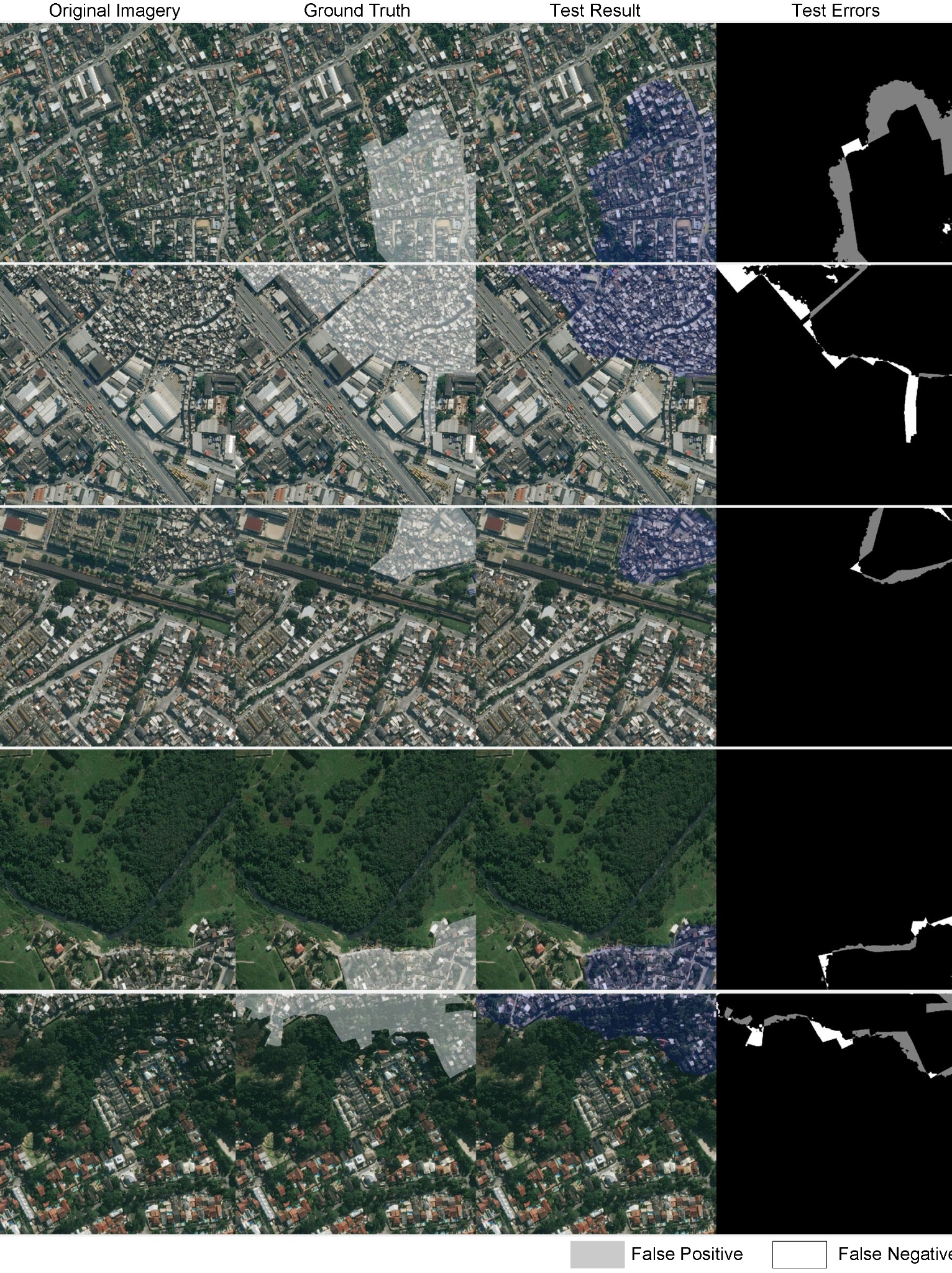
▪ Utilized deep learning approaches to analyze satellite imagery data, monitoring the three-dimensional expansion of favelas in Rio de Janeiro.
▪ Spearheaded outward expansion analysis by benchmarking semantic segmentation models (Unet/ResUnet/Segformer) on satellite imagery, achieving 79% IoU accuracy (benchmark: ~75%). Testing deep learning, unsupervised, and generative AI methods (ongoing).
▪ Developed an LSTM-based time series prediction model using 20-year favela boundary data (1999-2019) to predict expansion trends, enabling data-driven urban planning decisions.
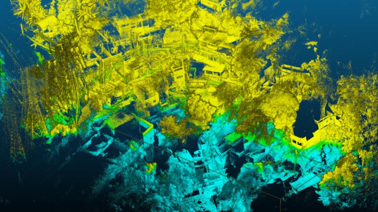
▪ Develop 3D expansion segmentation through satellite-point cloud fusion.
Metabolic Walking: Computer Vision for Pedestrian Behavior Analysis Under Varying Weather Conditions
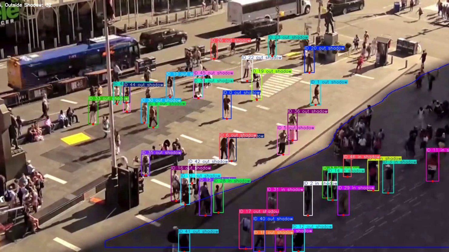
▪ Trained a shadow detection segmentation model with 95% accuracy, enabling precise classification of shaded areas in urban environments.
▪ Developed an automated pedestrian tracking model to extract movement patterns (walking speed, presence in shaded areas, demographic attributes), providing quantitative insights on pedestrian behavior in relation to shade.
▪ Analyzed pedestrian response to shading infrastructure under varying weather conditions, supporting adaptive urban design and mobility policy.
Project 1 - Favela 4D
monitoring the 3D expansion of slums in Rio
Deep learning in 2D expansion/change detecting
segmentation segmentation (segformer)
Project 2 - Metabolic Walking
analyzing pedestrian behaviour under varying weather conditions